

Protecting the inspirational landscape of South West Winchester
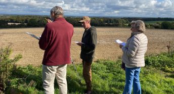
A team of experienced planning volunteers from CPRE Hampshire, the countryside charity, have carried out an assessment of a tract of chalk downland surrounding the south west of Winchester and concluded that it is countryside and green space of such high quality as to qualify as ‘Valued Landscape’, which requires it to be protected.
The land consists of one large area running south west from Oliver’s Battery to Hursley, and another large area running south east from Oliver’s Battery to Compton.
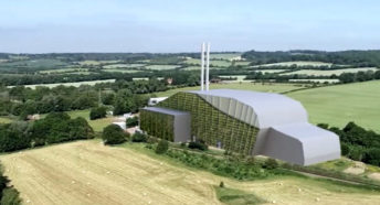
The first area is proposed for a development of 5,000 homes, ‘Royaldown’, with an adjoining area planned to house solar panels. The second area is put forward for commercial development, park and ride, approach road and solar panels.
CPRE Hampshire has made a physical assessment of the land in the context of a National Planning Policy Framework Valued Landscape which should be protected according to national planning guidance. CPRE Hampshire’s assessment highlights:
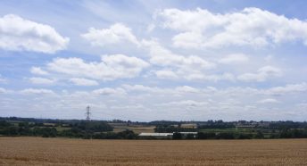
- the attractive and distinctive chalk downland and undulating landscape
- the attractive, undulating farmland, with tree belts, hedgerows, rural lanes and public rights of way
- the high-quality public experience of the landscape from public rights of way including the much-used Monarchs Way and Hurdle Way
- the limited development and overall sense of tranquillity
- the important contribution of these areas to the landscape character of the West Winchester Downs
Christopher Napier of CPRE Hampshire says, ‘These areas of land are part of the West Winchester Downs and a continuation of the main South Downs chalk landscape, which stretches from the Itchen Valley to the Test Valley. It is a very undulating landscape often with far reaching views over adjoining downs and lowland landscapes but also more visually enclosed landscapes in dry valleys and woodland.
Together the areas form an essential part of a tract of National Planning Policy Framework Valued Landscape of fine chalk downland with escarpments surrounding south west Winchester, which extends south west from St Catherine’s Hill to Hursley and then northwards to Farley Mount and Teg Down.
Landscapes are not only diverse and inspirational with breath-taking views but play a vital role in tackling the climate emergency by capturing carbon, cleaning the air, helping to slow flood waters and providing habitats for wildlife. As a feature of open countryside and green space, they are also important to people’s health and wellbeing, something that has been proved during the coronavirus pandemic.
The National Planning Policy Framework sets out that planning policies and decisions should contribute to and enhance the natural and local environment by protecting and enhancing Valued Landscapes. We strongly advocate that all local planning authorities in Hampshire carry out landscape assessments to identify Valued Landscapes in their Districts in the process of revising their Local Plans. This would ensure that where they exist, they are protected as required in Local Plans for current and future generations.’
Planning volunteers at CPRE Hampshire, along with the Save South Winchester Campaign Group and the Dever Society, are responding to Winchester City Council’s Local Plan Consultation 2021 which is currently out for public consultation until midnight on 12 April. This Valued Landscape assessment will be submitted as part of the CPRE Hampshire response. Meanwhile you can view it here: CPRE Hampshire South West Winchester Valued Landscape Assessment.