Exploring the capacity for rooftop solar across Hampshire and Sussex

We are keen to explore the rooftop solar potential in Hampshire and Sussex, in order to meet the government’s ambitious target of 70GW of solar energy by 2035. It’s a great way to generate clean electricity, cut carbon emissions, and protect land for food, farming, and nature.
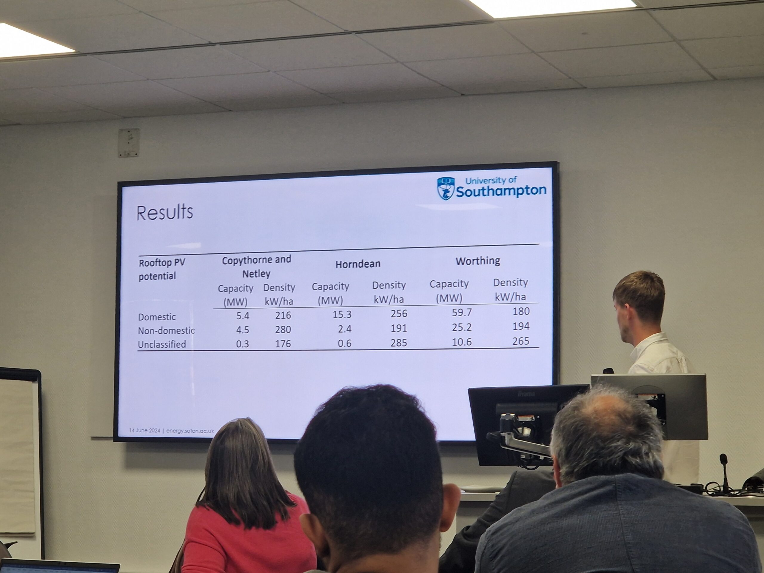
In collaboration with CPRE Sussex and CPRE Hampshire, a new study conducted by the University of Southampton has identified the potential rooftop solar capacity in three parishes. The study assesses how solar power could be harnessed in both large-scale utility projects and small-scale residential installations, making it a viable and sustainable option that safeguards the countryside.
The study builds on earlier research that mapped solar installations across Hampshire. The two research projects have now been combined giving an in-depth understanding of the current and potential solar landscape in Hampshire.
Understanding Hampshire’s Rooftop Solar Capacity
This research, led by Dr Luke Blunden, Research Fellow in the University of Southampton’s Energy Climate Change Division and Ellis Riddett, Senior Research Assistant in energy and sustainability, aims to showcase the potential of urban medium-scale solar panel installations; exploiting rooftop space on industrial parks, car parks and commercial rooftops.
Using data sets the research team have created an ArcGIS map which considers a number of factors including;
- Location
- Roof size
- Age of property
- Roof slope
The data is subject to information available at the time and does not assess the structural suitability of rooftop solar installation.
What is an arcgis map?
ArcGis is a geographic information system (GIS) tool that brings data to life by creating a map that can empower organisations to make data-driven decisions more efficiently.
How do I access the map?
- Visit Solar PV rooftop potential in Hampshire and Sussex (arcgis.com)
- To view the map, you can click on the image of the map or ‘Open in Map Viewer’ in the top right-hand corner.
What does the map show?
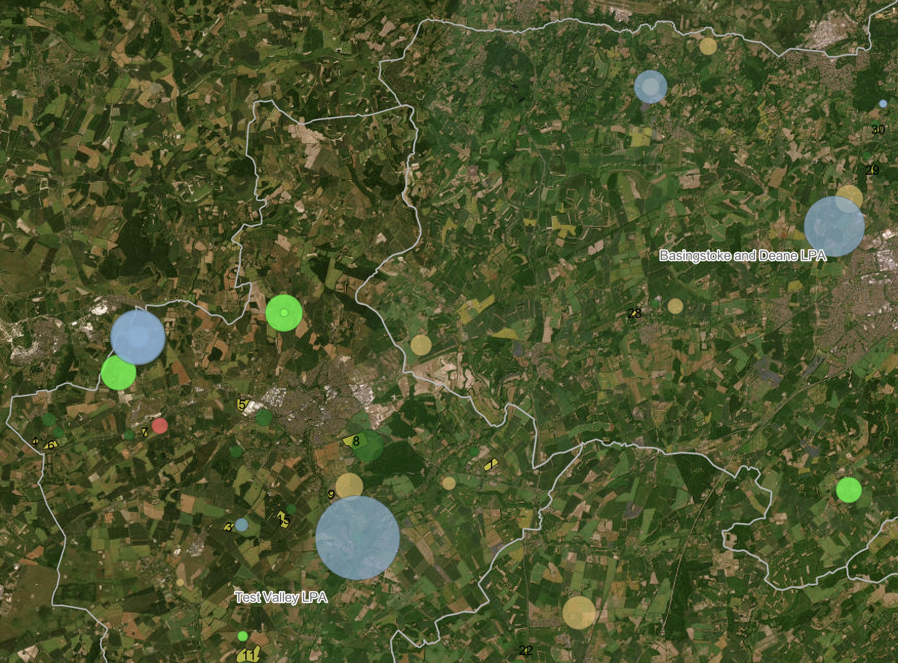
If you live in Hampshire, you can use the interactive map to see if there is an existing operational solar farm near you. It also includes the location of planned ground-mounted solar farms and their application status; ‘grid approval, pending, granted, appeal, NSIP Scoping’.
Simply click on the map, and zoom into the location you are interested in. The coloured circles depict the size of the solar farm and the colour indicates the status. The bigger the circle, the bigger the solar farm. If you would like to learn about the installation in more detail, you can click on the map. This will open a new window which displays information such as the name, location, capacity and applicant.
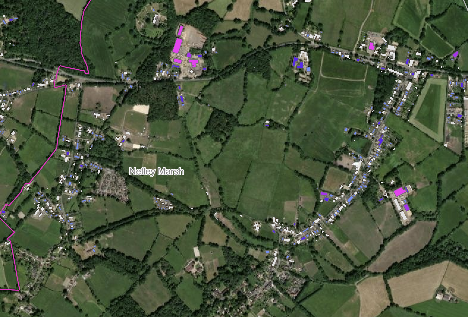
If you live in the parishes of Worthing, Horndean, Copythorne and Netley Marsh, you can also use the map to scope the rooftop solar potential in your area – as shown by the pink parish boundary lines. You can use the map as a guide to determine the best locations for solar energy initiatives by using the colour-coded key which depicts how much solar could potentially be generated from a given area. Simply zoom in, to get a better picture of individual rooftops and their potential solar capacity.
How can I use the map?
The map is designed as a tool to support local decision-makers and community groups to better understand how and where solar energy could be generated in the local area. We hope it will inform initial plans and guide resources so that they can be allocated strategically.
Please be aware that the research project is in Beta Testing and we are currently striving to update the map with as much information as possible. We welcome your feedback so please get in touch at serg@soton.ac.uk
Getting Solar Off the Ground in Hampshire
CPRE Hampshire and Sussex have collaborated with researchers from the Climate & Energy Division at Southampton University to create an online mapping tool which shows the potential for rooftop solar at key sites across Hampshire & Sussex.
Learn about the mapping tool


